
One of many variations possible to Walk 6, this walk also features woodland clinging to the ‘cliffs’ of the greensand ridge, the natural ‘valley of the butterflies’, the medieval gem of Ightham Mote… Garden of England views, dreamy ancient woods, pastoral scenes, oast houses … just incredibly refreshing to the south-east London dweller who spends so much time waiting for trains, waiting at traffic lights, wondering where the bus has got to – all that stuff. I’ve called the walk ‘figure of eight’ but actually it doesn’t cross over in the centre, just meets a point you’ve been to earlier (but you can obviously do what you like to it, adapt it to suit you). The blue line on the map above is a great variation: the ‘hidden valley’ Ightam Mote route, which is easy to follow.
Distance from SE London: 50 min drive from Sydenham
Access: Car needed, or taxi/bike from Sevenoaks or Hildenborough railway stations.
Refreshments: at Ightam Mote NT cafe (2.5 miles) and Shipbourne’s excellent Chaser Inn (3.3 miles)
Covered on Ordnance Survey Explorer 147 map
Click here to download a PDF of this walk to print out
Click here for realtime AllTrails GPS map where you can check your progress
The walk (3-4hrs/5 miles)
The walk in short
Points 1-2: 300m. Leave One Tree Hill NT car park and take path heading south (on your right). The path meets the Greensand Way; turn left, heading east
Point 2-3: 130m. At grassy glade with bench and view head left (northish) towards rear right hand corner of glade. Look for orchard ahead of you
Point 3-4: 130m. Walk north, parallel with edge of orchard. Turn right when you see white house ahead of you and you’ve just gone past northern edge of orchard
Point 4-5: 560m. Go east through the woods, down into a dip then up the other side, past the northern side of the orchard then, after passing another house on your right, you will come to a lane
Point 5-6: Cross lane and find footpath (you might come out opposite it or slightly south of it – if latter, turn left on lane until you find marked footpath on right).
Point 6-7: 280m Once on this path, stay on the path on the right heading south and walk past a field on your right
Point 7-8: 250m. The path now completely in woodland begins to bend left downhill
Point 8-9: 320m. The path descends Wilmot Hill beautifully among great trees with view on right. At bottom, the path joins the Greensand Way. Turn left (heading east) and you will soon come to a cottage with a nice garden
Point 9-10: 1km. Walk past cottage ignoring path off to the right (you’ll come back up that later) and continue as track becomes lane to Ightam Mote
Point 10-11: 120m. Turn right on lane just before Ightham Mote. Look for path over stile off to the left alongside field.
Point 11-12: 520m. Path goes along edge of field then through South Seers wood
Point 12-13: 500m. Leave woods and make for church ahead of you on same path
Point 13-14: Walk past rear of church then take path striking out west across fields
Point 14-15: 430m. Cross large field and enter Cold Blows woods (mostly conifers).
Point 15-16: 260m. Take left fork in woods
Point 16-17: 420m. Walk to Budds hamlet.
Point 17-18-19: 850m. Cross lane and, slightly to right, take path heading north through field uphill back to cottage.
Point 19-20: 850m. Turn left at cottage and follow Greensand Way path past boulders, ‘jungle’ of trees, etc, to Rook Lane/Rooks Hill
Point 20-21: Turn right on Rook Lane then, very quickly, left, up steps on footpath. Follow this path back to car park (800m)
Blue lines on map are alternative paths
Detailed description
Much of this will be very familiar to anyone who’s done walk 6. Park your car in the small NT car park on Carter’s Hill (OS grid ref 147:TQ560532) (point 1) then follow the broad footpath heading south (ignore the bridlepath heading left or east from the car park). The path joins the main Greensand Way path (which comes in from the right), then goes left, following the line of the ridge. Walk uphill then, after, say, 150 metres you’ll reach a small grassy glade (point 2) with a concrete seat offering a great view over Underriver and Hildenborough and as far as the Ashdown Forest. Here, turn left and head for the rear top right hand corner (north east corner) of the larger glade behind it (point 3), which, as I write, is adorned by great clumps of fabulous rose bay willow flowers (forgot my phone and camera so no pix, damn it).
Take the path heading north north east, and soon, through the trees you will see that you are skirting a large orchard on your right (points 4-5). As you draw level with the end of the orchard you will see a white house in a field ahead of you. Here, turn right (now heading east), parallel with the northern edge of the orchard. It can be very muddy here so take a side path if looks better. There are several paths but don’t worry about taking the wrong one, just bear in mind you are heading east towards a lane. Soon you will see a house on your right and you will emerge on an apparently nameless lane (a sort of extension to Rooks Lane) that runs north to the mighty metropoles of Bitchet Green and Stone Street. Emerge on the lane within sight of the house and you’ll need to turn left (north) then soon right onto a marked footpath (point 6). Sometimes, I’ve taken the drier path and emerged onto the lane exactly opposite point 6 – it’s not an exact science this bit so use the map, just use the relative positions of the orchard, the lane and the two houses to navigate.
At point 6, take the right hand footpath (the left one is nice also and leads down a ‘secret’ valley to Ightam Mote) through thickish woods now heading south. Soon this path will curve south east (point 7) and you’ll be right at the top of the greensand ridge again, at Wilmots Hill, walking down through incredibly old yew trees and towering beech with a fantastic view over Kent and East Sussex on your right (point 8). This is my single favourite stretch of path (pictured in the slide gallery below) among these walks. It’s atmospheric, yes, stirring even!! Ha ha.
At the foot of this path there are steps down to the main greensand ridge trail. Turn left and pass a lovely cottage (which we’ll see again later) (point 9). Walk along this now lane about one mile to Ightham Mote (point 10). This is a truly beautiful 14th century manor with glorious gardens. Before reaching it, turn right on Mote Rd, a quiet road next to Mote Farm. If you wanted to see Ightham Mote and visit its NT cafe you’d have to go straight on at this point. A few metres down Mote Rd you can cross a stile into a field where the path continues (point 11). Enter a rather magical small pine-dominated wood (South Seer Wood, point 12).
On leaving the wood continue on the path to Shipbourne church visible ahead of you (point 13). There’s a very nice pub near the church (Whiting & Hammond’s gastro pub The Chaser Inn) if you need refreshments at this point (not visible from the path). To continue the walk, turn right (point 14), now heading west on a path crossing a vast field towards some larger woods (a lot of pine again) called Cold Blows. Enter the woods (point 15) and walk a few metres to a fork junction. Take the path on the left here (point 16), ignoring the ambiguously positioned footpath sign.
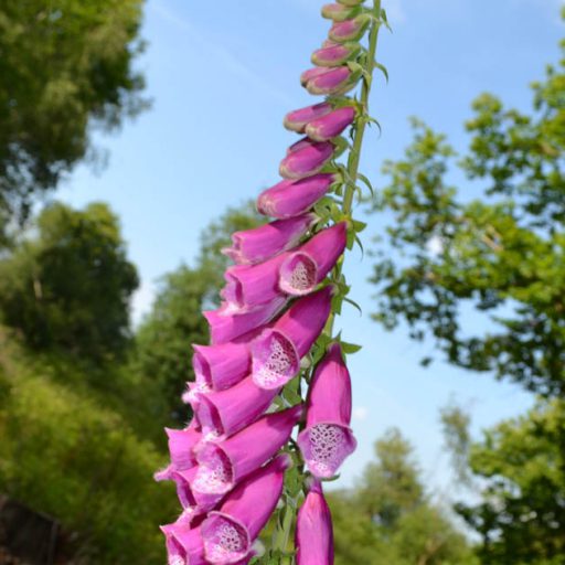
Soon you’ll descend through a dark coniferous tree tunnel (hideous mud in winter) and come out at Budd’s Green (point 17). Cross the road and turn right (east) then immediately left (northish) onto a footpath up the side of the field with hedgerows on your left. Continue for two-thirds of a mile up to the cottage mentioned above (points 18-19). Turn left here (west), now heading back to One Tree Hill, and walk past the junction with the path you earlier walked down. You’ll soon reach the mysterious, humid, sheltered area strewn with sandstone boulders described in walk 6 below the ancient tangle of almost black to bright green woodland clinging to the escarpment on your right. Look out for butterflies (red admirals, peacocks, orange tips, brimstones etc) here and less commonly encountered birds… a tawny owl flew right past us here on July 25, 2015.
Soon the path will pass fields on the left with donkeys, llamas, the odd pig, and sheep in them. Immediately afterwards, you hit Rooks Lane (point 20). Turn right (there are hardly ever any cars on this ‘road’) then very quickly left rejoining the path, now heading up some steps, climbing to get to the top of the ridge past more amazing beech trees clinging to the ‘cliff face’ (this bit of the ridge called Rooks Hill). Soon you’ll be back at the glade with the lovely view (point 21). Follow the path back to the One Tree Hill car park. If you fancy a drink now, just drive down the hill (left out of the car park) to Underriver and the excellent White Rock Inn with its glorious large grassy beer garden.
Donations
If you’ve enjoyed one of the walks on this site and feel it’s enriched your day, feel free to make a small donation here if you wish. It'll encourage me to add more walks, update information and work harder to improve accuracy and quality. Thanks a lot.
£3.00
Apart from Ightham Mote there are loads of less well known historical places to visit in the area such as 13th century Old Soar Manor and West Peckham’s saxon church.

Pingback: The woody wonder of ancient Oldbury: a shorter route – Kent walks near London
Pingback: Look to the light – Kent walks near London
Pingback: Birding on the Greensand Ridge at Underriver – Kent walks near London
Pingback: Basking case – Kent walks near London
Pingback: Moody blues on the way out – Kent walks near London
Pingback: Bluebells in north-west Kent: where’s best? – Kent walks near London
Pingback: Splendid isolation – Kent walks near London
Pingback: Bluebells on Kent walks: where is the cobalt carpet? – Kent walks near London
Pingback: Let’s hear it for foxgloves – Kent walks near London
Pingback: New(ish) walking route – Hosey Common and Chartwell circular – Kent walks near London
Pingback: Bluebell fun facts – Kent walks near London
Pingback: Best bluebell walks in north-west Kent 2019 – Kent walks near London
Pingback: Merry Christmas to all – and enjoy a winter walk why don’t you – Kent walks near London
Pingback: Best walks for autumn colour in north-west Kent – Kent walks near London
Pingback: One Tree Hill figure-of-eight walk, in the light of August – Kent walks near London
Pingback: Find a north-west Kent walk that suits you – Kent walks near London
Pingback: Special trees on these Kent walks – Kent walks near London
Pingback: Bluebells around Shoreham, Ide Hill, Downe, Kent – Kent walks near London
Pingback: Getting lost on these walks; who wrote this rubbish! – Kent walks near London
Pingback: May soleil and last chance for bluebells – Kent walks near London
Pingback: A new walk (Hever) and last chance for bluebell walks – Kent walks near London
Pingback: Bluebells north-west Kent 2016 – Kent walks near London
Pingback: An early Easter as the meadows and woods wake up – Kent walks near London
Pingback: Eight of the best walks in north-west Kent | Kent walks near London
Pingback: So long autumn… hello winter | Kent walks near London