
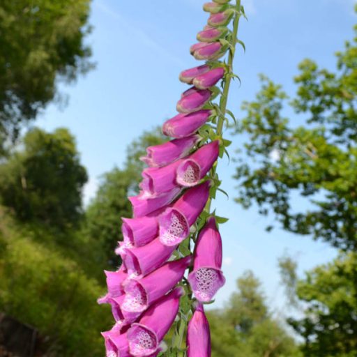
Enjoy a variety of great views throughout this outstanding walk (photos below), which climbs up into the North Downs from Otford railway station. Stroll through fields and woodland rich in wildlife and birdsong, with abundant wild flowers. More strenuous than most of the other walks on this site, but hey, this is Kent – you won’t be needing crampons and ropes (though a cable car would be handy at one point in particular). Occasionally livestock in field between points 5-6.
Note: Can join up with Walks 14 to make it 10 miles and also try Walk 19 (4.5 miles) which covers some of the same ground. There is sometimes (20% of time?) a herd in fields approaching point 6
Distance from SE London: 40 min drive from Sydenham, 40 min from Peckham Rye station on train
Access: Easy. Otford railway station (direct trains from London Blackfriars, Denmark Hill, Peckham Rye, Catford, Bromley South, Ashford, Maidstone, Shoreham, Sevenoaks etc). About one hour from central London, 45 mins from Denmark Hill/Herne Hill, 20 mins from Bromley. If travelling by car Otford has a big car park off its High St by the recreation ground, just south of the roundabout and pond.
Covered on Ordnance Survey Explorer 147 map
To help you with this route:
Download pdf of walk with map by clicking here
Ordnance Survey GPX map of route for real-time location finding (the walk as described below)
The walk (3-4hrs/6 miles)
The walk in short:
Points 1-2: 215m. Leave Otford station (heading north on Station Approach) and after a few metres turn right (heading east) on the A225 (Station Road). Now, turn right at Pilgrim’s Way East. After a few metres take the path opposite, uphill signposted North Downs Way (looks like a private drive)
Point 2-3: 1km. Path enters light woodland and has some steps in it. Seat on left to admire view. After gate is grassy field. Keep on right hand side and pass through trees to lane junction
Point 3-4: 700m. Continue along lane heading east (Birchin Cross Rd) until you rejoin the North Downs Way on right. After a few metres at path t-junction turn left (east). Walk alongside field on your left, past large isolated house to Shorehill Lane
Point 4-5: 340m. Turn left down Shorehill Lane to Birchin Cross Rd. Turn left (west-ish) then after a few metres look for path through woods on right, across the lane
Point 5-6: 800m. Walk through woods (great pines) and emerge in secluded field. Walk uphill diagonally across field to top left hand corner. Pass through two more fields separated by stiles, hedges/trees until you reach a lane (Magpie Bottom) Occasionally there are cows and bulls in these fields but they are large fields so can be avoided – if in doubt take the valley floor ‘alternative route’ in red above).
Point 6-7: 740m. Turn left on lane then very soon look for footpath resuming on right. Take path through woodland and fields to Romney St (there are several paths as you approach Romney St – doesn’t matter which you take)
Point 7-8: 650m. Turn left (west) at Romney St (the Fox and Hounds pub has sadly closed) and continue along path/alley beside a large house with a hangar and airstrip. Path opens out on to chalk upland. Great views. Still heading westerly. Continue on path down very steep hill where golf course used to be on floor of deep valley
Point 8-9: 400m. Pass through hedgerow ‘corridor’ then up very steep hill to copse
Point 9-10: 380m. Leave copse, walk diagonally across field then another field to join farm track
Point 10-11: 300m. Walk up track through little valley to Dunstall Farm. Turn right at farm buildings and just before a circular cattle barn, turn left on footpath across field to woods
Point 11-12: 850m. Enter woods, walk down steps, then to A225 road by Shoreham station (catch the train here if you’ve had enough/short of time)
Point 12-13: 260m. Walk under railway bridge down Station Rd, past Darent Valley golf club and take footpath on left
Points 13,14,15: 2km. Go past cricket pitch, across narrow lane and continue to Otford. Turn left at village high street to return to station.
More detailed description
Otford station is close to where the walk starts, so we’ll save the lavish delights of the village ’til the end.
On leaving the station (point 1) on Station Approach (exiting via the ticket hall) turn right at the main road (the A225, Station Road) towards the valley wall of hills to the east. Walk alongside a tangle of tree and chalk pits on the right for a few metres. How they were formed I have no idea; could be old chalk mining from medieval times and earlier. Turn right on to Pilgrims Way East. After a few metres (maybe 30?) take the broad path called North Downs Way uphill that you see opposite you (point 2). Best not to walk up the private drive next to it. Take it slowly on a warm day, it’s a longish climb, though no bother for a fine figure of a humanoid like your good self. At first, this path is more like a suburban driveway but it soon becomes a pleasant woodland path with some steps in it.
The North Downs Way path opens out after a while and soon there is a seat off to the left from which you can take in the glorious view behind you. After entering woodland you reach a gate. After this is a grassy field – a delightful spot. Keep to the right hand side and head for the right hand corner (point 3) where the path continues through woodland (Hillydeal/Flatdeal woods). On emerging by a triangular junction of two quite busy country lanes, walk along Birchin Cross Rd heading east (ie continuing in the same direction as you have been) for maybe 100 metres until you reach the North Downs Way (Pilgrim’s Way), again on your right. After a few metres turn left at a T junction of the path and continue east (at this point there is a detour to the main North Downs escarpment very close by). Soon you reach a stile or gate and leave the woods to walk along the side of a field with a barbed wire fence on your left. You will walk past the grounds of a large isolated house. There’ll probably be horses or sheep in this field or the ones beyond it. Continue walking for several hundred metres until you hit the narrow Shorehill Lane (point 4). Turn left (north) and walk down the lane until it meets Birchin Cross Rd.
Here, turn left down the lane (heading back west) for a few metres until you see a slightly hidden signed footpath on your right (point 5), which meanders off through woodland (brilliant bluebells here in May). You are now walking roughly north. It’s getting all very nice, and you should be in high spirits by now (particularly if you possess a little something to perk you up), buoyed by the verdant bounty around you. Follow this path for a few hundred metres through lovely woods in a little valley (admiring the lofty pines on your right) and you will emerge in a ‘hidden’ grassy field with wild flowers on a hill. This is a delightful spot that feels really isolated (pictured below). It’s very beautiful and is actually an Site of Special Scientific Interest called Magpie Bottom (ha ha). It has amazing biodiversity as a rewilded chalk grassland, and if you watch this short YouTube clip you’ll understand more about it. There’s a lot of history here too. It was an alternative to the Pilgrim’s Way, this bit, for people who wanted to stay higher up and avoid robbers. Smugglers passed through, using a pub no longer visible called the Pig and Whistle and there are ancient mine workings called deneholes dotted around (there are some in the woods).

Emerging into the ‘hidden’ meadow between point 5 and 6
Cross the stile at the end of the path and walk up the field, diagonally, into the corner – it’s obvious where you have to go. Now you are walking on top of the downs. Follow the path over a couple of stiles through fields until you hit a lane – this is also called Magpie Bottom (point 6). Turn left onto the lane and walk downhill 20 metres and then turn right onto a path (resuming going north). Soon you will be walking along a field, then over a stile and another field. If the path here is too ploughed up and muddy, you can walk parallel with it in the woods on your right. Don’t worry about the cows if they are on the path, they are placid (actually, how do I know that? Just because they haven’t butchered me yet…). You are still walking north. I’m a bit hazy about this bit… but it matters little – you are heading north towards Romney St (one day maybe the pub will reopen but no signs as I update this in March 2017). This is all lovely farm land/copses, quite similar to the Downe area in Walk 1.
Where’s the pub gone?
After the next field (hope I’m not confusing you) fork right, following the blue bridleway markers. If you can see the white buildings ahead of you at this point, make for them. One was the Fox and Hounds. I think this pub has been lost for good… such a shame because it was brilliantly positioned to serve walkers.
Anyway, in front of the pub (point 7), or what was the 400-year-old hostelry, turn left and head west. The path will take you past a large house with high security. Look carefully and you might see there’s a light plane or two parked in the large garage. Certainly, there’s a grass airstrip just beyond the house. Annoying dogs in the back might blindly bark at you from the other side of the hedge as you stroll to the next field. Here, glorious views open up of north-west Kent to London. You can see the Shard etc in the distance, and you realise how high up you are. Follow the path west/north/west and soon you’ll be walking down a very steep hill in a dry valley. The path here crosses an old golf course, now disused, at the valley’s foot through a thoughtfully planed avenue of low trees beginning to form a bocage style hedgerow (point 8). To the left is the evocatively named Magpie Bottom. The valley is a great place, especially now there’s no golf course (I play golf so love a good course, but have to say that the valley is enhanced now it’s gone wild). On emerging you will be faced with a steep uphill section on a grassy flank of the dry valley dotted with wild flowers. Look out for beautiful chalk hill blue butterflies and orange tips here. Take your time, don’t rush. Soon you will be in a copse at the top of the hill.

The huge view towards London soon after turning away from Romney Street heading west
On emerging from the copse head diagonally across a field planted with rape (point 9). If you time it right, you will be surrounded by the giant crop. It’s like a scene from the movie Looper (you’ll know what I mean if you’ve seen it). But if it’s just been harvested, bad luck – you’ll just be walking across a barren field. This might be two fields, sorry I’m a bit hazy here again. But you can’t get lost, you really can’t.
The path eventually bends round to the right, after a gate, (point 10) leading across a pleasant, shallow valley up to a farm. If you look directly down the valley you should see the the Queen Elizabeth bridge at Dartford. Continue on the track towards farm buildings (Dunstall Farm). When you get into the farm yard turn right and look for the continuation of the path on the left through a field with crops. If you find yourself walking past the Round House, which houses bulls and cows you’ve gone a bit too far. The path on the left is just before this, not quite opposite the Round House. I like the fact the farmer’s relaxed about the footpath going past his precious livestock. Take the path, which heads to more woods (point 11). Enter the woods, which must be pretty ancient, and soon find yourself descending on steps among giant beeches. This woods is very impressive and atmospheric.

The steps down through the ancient Dunstall woods, point 11
Keep going straight and after a few hundred metres the path becomes more stony, there are houses on your right and you hit the A225 (point 12). Take care and cross this fast but not-so-busy road, heading towards Shoreham on Station Road (still heading west). The railway station is on your right. You can go home from this point, of course, if there’s something on TV you want to catch, or you are bored.
Pubs and cafes on my north-west Kent walks
Back to Otford station
You could go straight down the road to the pub in lovely Shoreham village if you wish, then come back up and catch the train (see walks 2 and 3). But to finish this walk in triumph let’s continue back to Otford. It’s not far now after all. Go down Station Road and take the path on the left just past the golf club (point 13). Follow this path the mile and a half back to Otford, past the nice little cricket pitch, across a lane and continuing on the path. You can extend the walk by turning right on the lane just past the cricket ground (point 14) and walking down to the Darent river, and then taking another path back to Otford after that. The latter route is certainly more scenic.
The main route path comes out on to Otford’s recreation ground. There are tea rooms and pubs just beyond on the High St (point 15).
Otford is a medievally kind of place with lots of Canterbury pilgrim overtones. It also has the remains of Otford Palace, which those who watched Wolf Hall on telly will be interested to know was built by Archbishop Wareham in 1515 to rival Cardinal Wolsey’s palace at Hampton Court. All that’s left is one tower (Wareham fell out of favour), but do walk around it and the alms houses nearby – all very atmospheric. I’ve never been in any of the pubs in Otford, incredible to say, so I won’t recommend one over another.
Another version of this walk here (actually pretty much the same walk but more detailed directions)
More great Kent walks from John Harris’s Walking in England website
Other reasons to visit Shoreham
There’s plenty more of interest in the village – Castle Farm and its stunning fields of lavender (en route to Lullingstone – a superb farm shop too with renowned beef, dried flowers etc), the Shoreham Aircraft Museum on the High St (so many of the villages of this area keep the memory of the Battle of Britain alive), the new (April 2022) Samuel Palmer pub, the boutique Mount Vineyard…
History
Magpie Bottom was apparently on a smuggling route from the coast to Dover. The ruins of a pub, the Pig and Whistle, can still be found off the lane on the western side of the valley, a pub where smugglers would rest up before their final route into the capital. Apparently, a red light would warn of the presence of customs officials. Also, in Great Wood and Dunstall Woods there are ‘deneholes’, where chalk and maybe flint was excavated by pre-medieval peoples. More famously, the village was home for a while to the great landscape painter Samuel Palmer in the mid-19th century. He lived in a rundown shack/cottage he called Rat Abbey before joining his dad in the rather more salubrious Water House, next to the river where it meets Church St. His friends, the Ancients (including William Blake) would often swing by.
Donations
If you’ve enjoyed one of the walks on this site and feel it’s enriched your day, feel free to make a small donation here if you wish. It'll encourage me to add more walks, update information and work harder to improve accuracy and quality. Thanks a lot.
£3.00
Shoreham was the birthplace of the first unfortunate soldier to be executed for desertion in the first world war. Private Thomas Highgate was shot after the Battle of Mons, on September 8, 1914. Total barbarism. Several aircraft have crashed here too, most notably an Airspeed Courier in 1934 (during a thunderstorm) at the junction of Cockerhurst and Castle Farm Rd (very close to walks 2 and 19) and a Dornier 17 among others during the Battle of Britain (details and mementos of the latter in the Shoreham Aircraft Museum – this was the incident where the crew ended up in the pub). More on Shoreham here.

Pingback: Summer is here; time for Pluto – Kent walks near London
Pingback: Splendid isolation – Kent walks near London
Pingback: Kent walks near London
Pingback: Bluebell fun facts – Kent walks near London
Pingback: I’ve heard some bull in my time… – Kent walks near London
Pingback: Walking at Fackenden Down and Magpie Bottom, Shoreham, Kent – Kent walks near London
Pingback: Shoreham, Kent – a perfect village for walkers – Kent walks near London
Pingback: Quieter Shoreham walks – Kent walks near London
Pingback: In the grip of the beast: snow in north-west Kent – Kent walks near London
Pingback: Bluebells around Shoreham, Ide Hill, Downe, Kent – Kent walks near London
Pingback: New walk: Shoreham’s mystery eastern valleys – Kent walks near London
Pingback: A new walk (Hever) and last chance for bluebell walks – Kent walks near London
Pingback: Best bluebells near Shoreham – Kent walks near London
Pingback: An early Easter as the meadows and woods wake up – Kent walks near London
Pingback: Christmas holiday walks | Kent walks near London
Pingback: Eight of the best walks in north-west Kent | Kent walks near London
Pingback: The walks | Kent walks near London
Pingback: New walk added | Kent walks near London