
This is the closest walk on this site to south-east London. It’s made up of superb National Trust-maintained woodland, with fields and, er, trains. There are great scots pines, chestnut groves, heather clumps, streams, ponds and bridges, and a multitude of paths to explore. Chislehurst and Petts Wood are both deceptively interesting suburbs with lots of history and nearby places of interest. Perfect for families, especially those with dogs. Navigation in woods isn’t always easy, especially with so many paths to choose from, but I’ll provide pointers to make it very difficult to get properly lost. On the map below, the red route (equally scenic) shows how you can make it a circular walk from either Chislehurst or Petts Wood stations. Easy walk, no steep slopes. Great fun in the woods between points 4-6 as you work out which path to take (it actually doesn’t matter too much, but please read my instructions carefully).
How to get there: trains on Charing Cross to Orpington via Hither Green stop at Chislehurst and Petts Wood. A little further away but well within walking range is Bickley station, which you can reach direct on the Victoria-Orpington line (via Brixton, West Dulwich, Herne Hill etc and which also serves Petts Wood) and the Blackfriars/Thameslink line via (Elephant, Denmark Hill, Peckham Rye, Nunhead etc). If driving, park in Goshill Rd, or Barfield Rd.
Distance from SE London: 20 min drive from Sydenham, 10 min on train from Hither Green
PDF version of this walk to print out and print out National Trust map of woods (click on ‘map of property ‘tab top right)
The walk (3.5 miles/1.5 hours)
Directions
Points 1-2: 500m. Leave Chislehurst station and turn right towards Summer Hill (A222). Cross this busy road via the pedestrian footbridge (which has a ramp). Walk down Goshill Road.
Point 2-3: 1km. Eventually you’ll see a barrier to the right barring your way, and a footpath on the left. This path splits. My alternative red route is on the left, going slightly uphill. The primary route, in orange on the map, follows a stream (Kyd Brook) as far as a little bridge. (If you want, you can turn left by this bridge and join the red route further up the path by Coopers School.) On the orange route at this point, turn 90 degrees right and walk towards the railway line, then follow the path left towards the pedestrian bridge over the line. Don’t cross the bridge (unless you fancy going to the excellent Jubilee Country Park – see below), but continue on the path on wooden boards, over the Kyd Brook stream towards the woods.
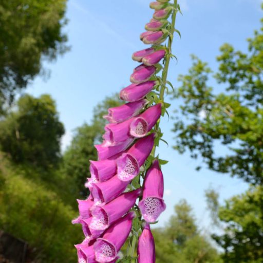
Point 3-4: 900m. On entering the woods at a rather muddy point, turn left (going north), taking a path parallel to the edge of the field, gradually uphill. Good bluebells here in late April. After about 500m the path goes between two fields. The field on your right has a pine clump in it and a clump of deciduous trees; on the left, the field, often with sheep in it, slopes downhill.
Please read my navigation notes at the bottom of the page about finding your way in the woods at this point – the multitude of paths means it’s not an exact science – but there are certain markers to look out for (ditches/heather patches etc), and there are lots of people around usually
Point 4-5: 300m. Turn right (head east) at top of field, keeping the field immediately on your right and woods on your left, noting tall pines and a superb oak just past a bench and some dilapidated old iron railings that I rather like. Enter the woods, cross its main north to south path and look for a path heading east east north through holly which brings you out into a little clearing where you’ll find the Willett Memorial… if not sure, ask a passing dog walker. But if you think you’ve gone wrong, just scout around – you’ll stumble across it because several paths converge on it. Note the young tulip tree in the south of the clearing. Read about William Willett here.
Point 5-6 1km. Exit the clearing in its south eastern corner (ie take the second, or third – doesn’t matter– on the right from where you entered the clearing) and continue walking for about 300m in a roughly south/south easterly direction. Don’t worry about being on the exact right path… as I say, there are so many paths it would very difficult, and boring, to describe which exact one to take. You may find yourself crossing a small ‘valley’, going over a ditch on a little log bridge. If so, fine, not to worry, just look for one of two heather patches (marked well on the NT map) with embankment path in this part of the woods and take the main path through/past the heather going south. You’re bound to stumble across it. (The heather is a nice touch from the NT… returning part of the woods to a habitat which was far more extensive in days of yore. The presence of so many pines in the woods and patches of sandy soil hints that the woods was actually heathland in some previous era.) You’ll probably be able to hear traffic on an unseen main road to your left at this point. Keep walking south as far as you can – you’ll probably hit another heather patch/embankment combo (it might be your second or third depending on which path you left the Willett clearing on). You’ll hear the odd train ahead of you after a while and after a few hundred metres you’ll see you are above a railway cutting.
Point 6-7 300-400m Turn right on any path heading west parallel with the railway – so the railway is on your left (mainline Victoria to Dover). Continue to walk parallel with the railway and soon the path descends to cross a stream/ditch and a tunnel under the tracks.
Point 7-8 900m Go through tunnel under railway and emerge onto Hazelmere Rd, turn left and then immediately right up Towncourt Crescent. Continue all the way to Petts Wood Station. The Daylight Inn pub (named in honour of William Willett) is in the town square just before the station.
Donations
If you’ve enjoyed one of the walks on this site and feel it’s enriched your day, feel free to make a small donation here if you wish. It'll encourage me to add more walks, update information and work harder to improve accuracy and quality. Thanks a lot.
£3.00

Walking along the edge of the field just after point 4 (late autumn)
The route marked in red on the Google map above
This route can be used as an alternative to the first part of the walk or you can use it to make a good Chislehurst circular walk. Use in conjunction with National Trust Map here.
A Take the footpath heading off up hill at the end of Goshill Road, skirting Pond Wood (on the National Trust map this route is marked in yellow). Continue about 1km until you meet a track (Botany Bay Lane, that links Tongs Farm with Chislehurst Common). Turn left on to this track then immediately right on a footpath passing the southern edge of Coopers’ School Playing Field.
B After passing the playing field, the path goes downhill then turns left alongside a large pond (Flushers Pond). It then bends right, uphill, to join the main route (in orange on my map) at Point 4.
C Continue on the orange route to Point 7 then instead of going through the tunnel continue straight on, parallel with the railway (the ‘upper path’ though the sweet chestnut grove is the more pleasant of the two paths that do this) until you rejoin the Kyd Brook that emerges from another tunnel under the railway, across the little bridge and then next to the railway line, going past the pedestrian bridge. The path turns sharp right towards Tong Farm buildings, then, upon reaching the Kyd Brook again, turn sharp left and walk next to the stream back to Goshill Rd.

Pines near point 5 (late autumn)
Navigation notes
The National Trust web page for these woods and its excellent map which you should print out
Hidden London webpage on Petts Wood
First off, the getting lost bit. The walk is pretty straightforward up to halfway between points 4 and 5. It’s impossible to say exactly which path to take to get to the Willett Memorial, or which one to reach the first patch of heather after point 5. I’ve walked in these woods for years and I still get a bit confused! This is because, unlike say Ide Hill woods, there are so many paths going parallel with each other and crisscrossing each other. I think it’s part of the fun really. I strongly recommend doing the walk having printed out the NT’s excellent map here. But the thing is, you will blunder your way somehow – anyway there are always lots of dog walkers around to ask. The golden rule after point 5 is that you will always hear the traffic on your left on St Pauls Cray Rd (the A208) as you are walking south and you’ll know when you’ve reached Point 6 because there’s a railway line there. So your points of reference are the A208, which you can hear, and the railway line (which you can hear sometimes too).
As with finding the Willett Memorial, finding the heather patches is fun too. On the orange route there are two of these, though you may bump into three by taking the more easterly path from the Willett Memorial clearing… it doesn’t matter – you’ll hear the road up ahead and know it’s time to turn right and walk parallel with the unseen road down towards the railway line.
A little bit of history – the creation of suburban classic
The first part of the walk is through the Hawkwood Estate; then you enter Petts Wood proper passing through its ‘sub woods’ Edlmann and Willett.
The suburb of Petts Wood is quietly fascinating. A classic 1920s-30s suburb, the eastern part is particularly posh, all mock Tudor mansions and manicured lawns. The houses and gardens are particularly huge on Birchwood Rd/Hazelmere Rd (Charles de Gaulle briefly lived in Birchwood Rd in 1940 after escaping France). The woods themselves are believed to have been planted late in the 16th century by the Pett family, who were prominent shipwrights and are mentioned in Pepys’ diaries.
The man behind the suburb was Basil Scruby, an entrepreneur from Harlow. He had already built at Newbury Park and elsewhere when he turned his attention to Petts Wood in 1927, securing an option on 400 acres of woodland and strawberry fields and proceeding to buy it in sections. Also that year, the National Trust acquired most of what was left of the wood and erected a granite obelisk and sundial (showing British Summer Time) in William Willett’s honour. The same year, Colonel Francis Edlmann got hold of a neighbouring swathe of woodland and added it to his Hawkwood estate. Robert and Francesca Hall bought the Hawkwood estate after Edlmann’s death, and later presented it to the National Trust. Scruby paid Southern Rail £6k to build the station in 1928, an interesting piece of architecture. The whole place has a real 1930s feel about it; one of the London suburbs you can most identify with this period.

Edlmann wood near point 3 (early autumn)
Fauna and Flora
A high number of bird species (click here for a fine bird list) are often seen in the woods: hobbies in summer, kingfishers by Flushers Pond and the Kyd Brook, siskins and goldcrests, among them. Lots of woodpeckers of all three UK types but too many damn parakeets, especially in the western part of the Hawkwood Estate. The 1987 storm change the wood’s walking routes enormously as fallen trees blocked them; I’m one of those people who was brought up on the old paths and still can’t quite get my head around the new ones. The NT has done a great job maintaining these woods of pine, oak, ash, chestnut, holly, lime etc, there’s a sense of spaciousness and variety. It’s no tangle of trees and impenetrably dense undergrowth.
Read more here, at the NT’s page for Petts Wood
Also visit …
Chislehurst Caves – seriously good fun for all, massive caves with incredible history in wartime as a shelter, in ancient times, and in the 60s and 70s as a gig venue for the likes of Jimi Hendrix and the Rolling Stones. The guides might well be rather good at telling scary yarns too; the last time I went (I was only 9!) they were, anyway. Very close to the train station.
Jubilee Park – if Hawkwood/Petts Wood isn’t enough greenery for you, to the west of the Petts Wood-Chislehurst line, is Jubilee Park, 62 acres of wildflower meadows, hedgerows and semi-natural ancient woodland. To reach it just cross the two rather scenic pedestrian bridges over the railway lines between points 2 and 3 on the orange route (see map above), emerging on to Little Thrift close. Then, take the alley opposite which takes you over the Orpington-Victoria/Charing X line into Jubilee Park. Friends of Jubilee Park have a fine website with bird sightings, butterflies and moths and wartime history.
Pubs
The Daylight Inn in Petts Wood is a huge mock-Tudor landmark, dominating Station Square – a good spot for a post-walk snack and drink while awaiting your train home. Chislehurst is better for a choice of pubs though – the Ramblers Rest, the Crown, the Tiger’s Head, the Bull’s Head and the Imperial Arms are my favourites – click on the links for locations. The easiest to get to from the walk, are the Tiger’s Head and the Crown I’d say.
